Front
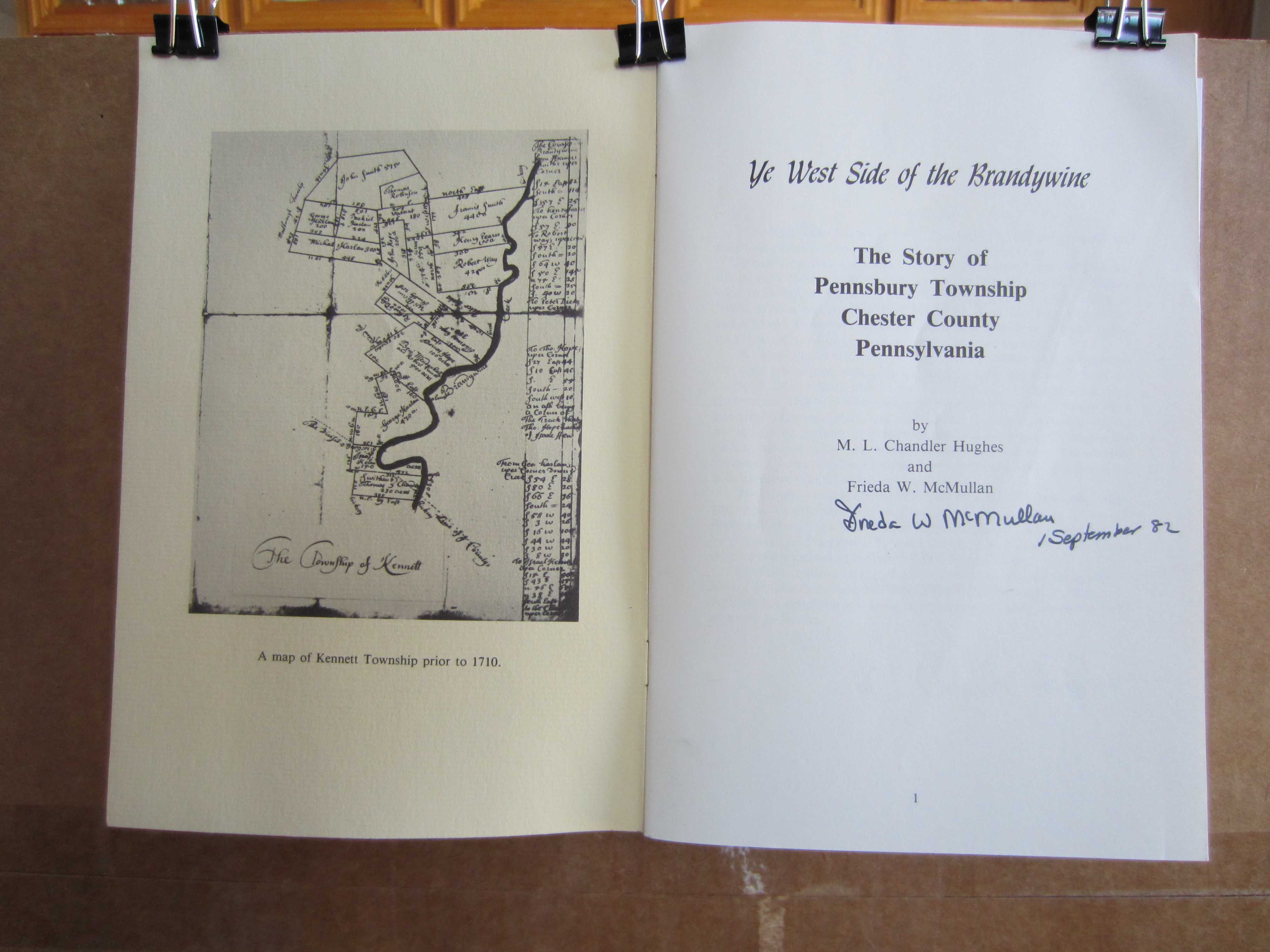
Inside Cover (1710 Pennsbury Map ) & Page 1 (Title Page)
Page 2 (Publishing Information) & Page 3 (Introduction)
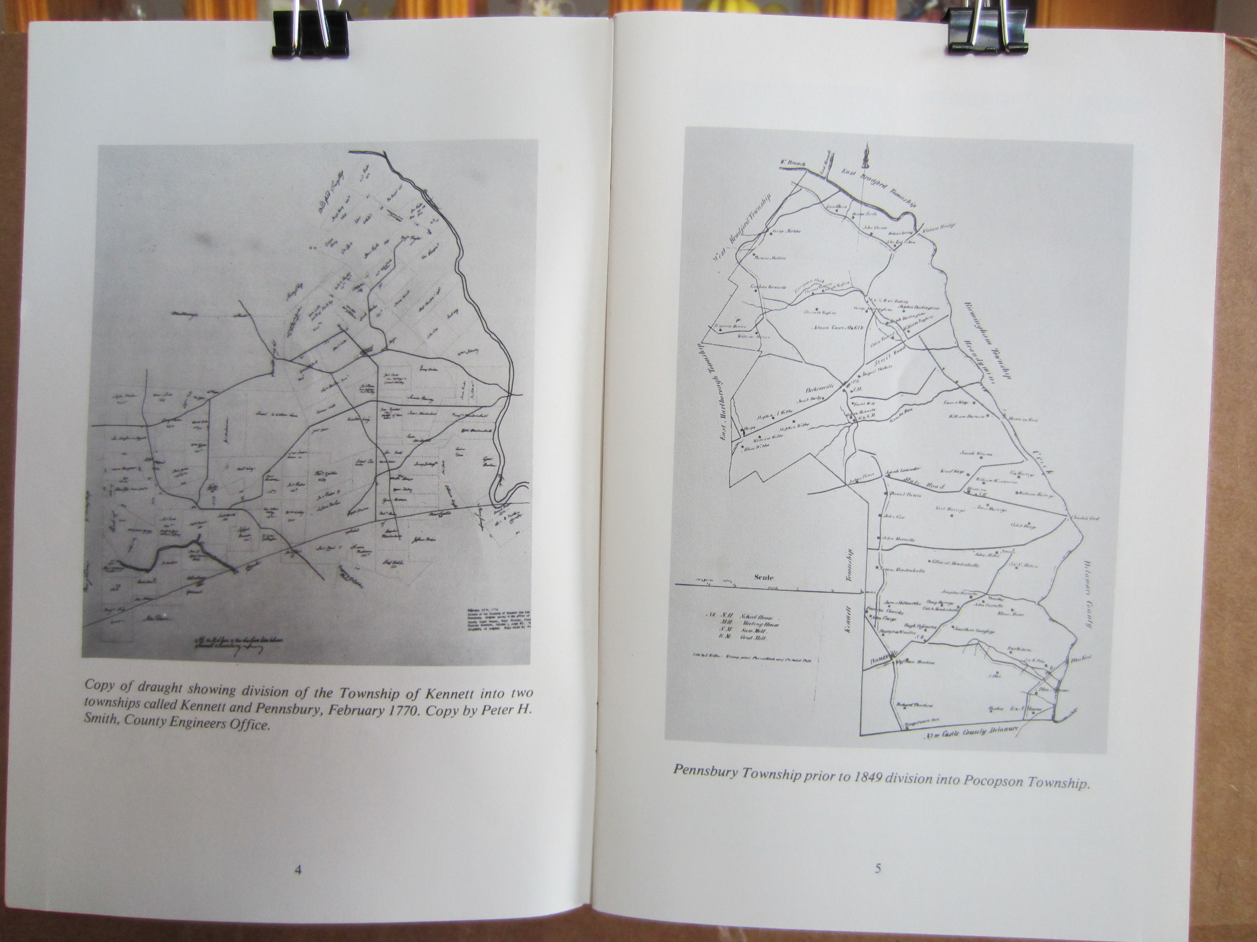
Page 4 (1770 Pennsbury Map of division from Kennett, with landowners) & Page 5 (1849 Pennsbury Map at division into Pocopsin)
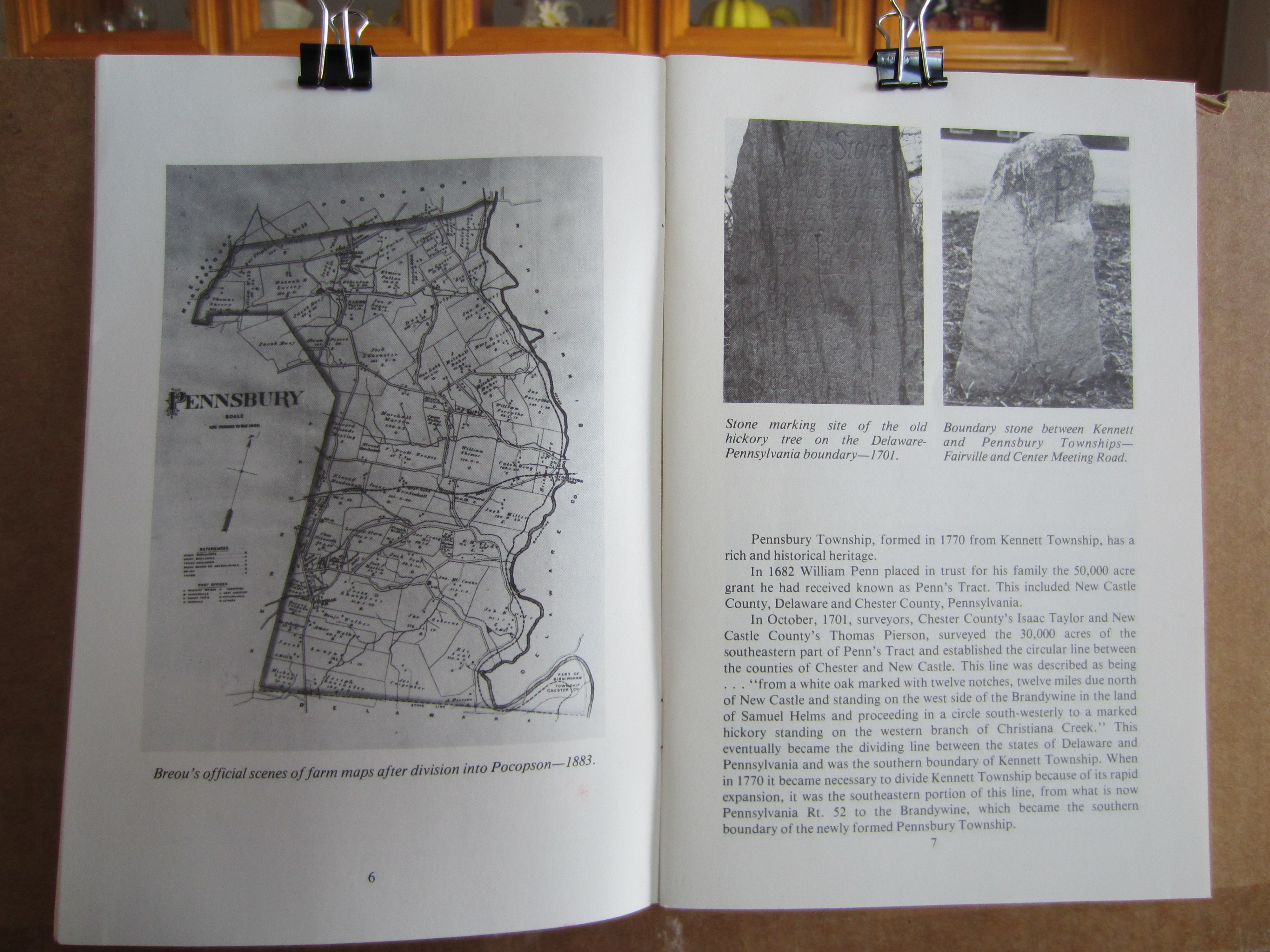
Page 6 (1883 Breou farm map after Pocopson division) & Page 7 (Stone markers & beginning of history text)
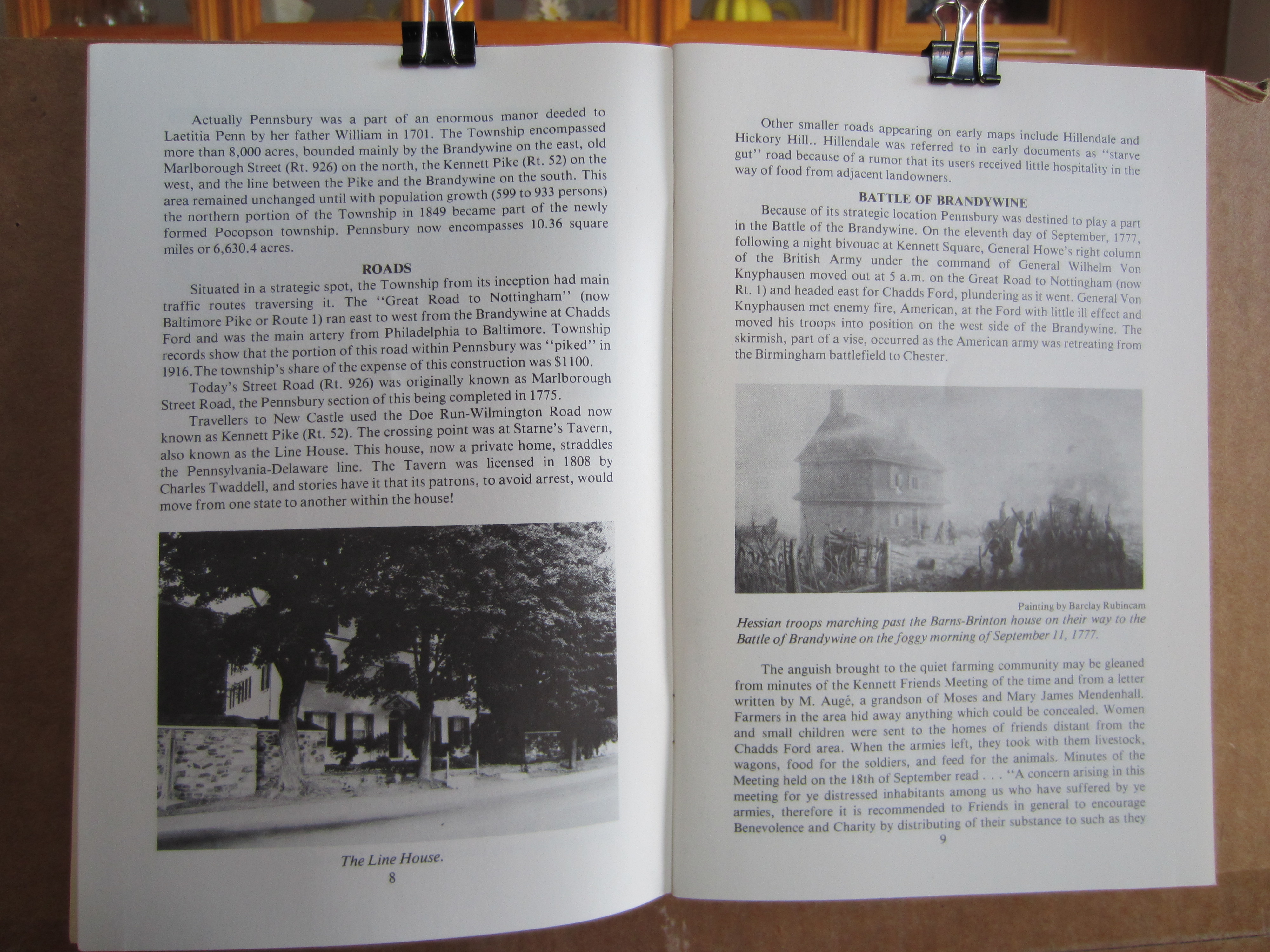
Page 8 (History; completion of Street Rd in Pennsbury 1775, Line House photo) & Page 9 (Battle of Brandywine, Barns-Brinton house photo )
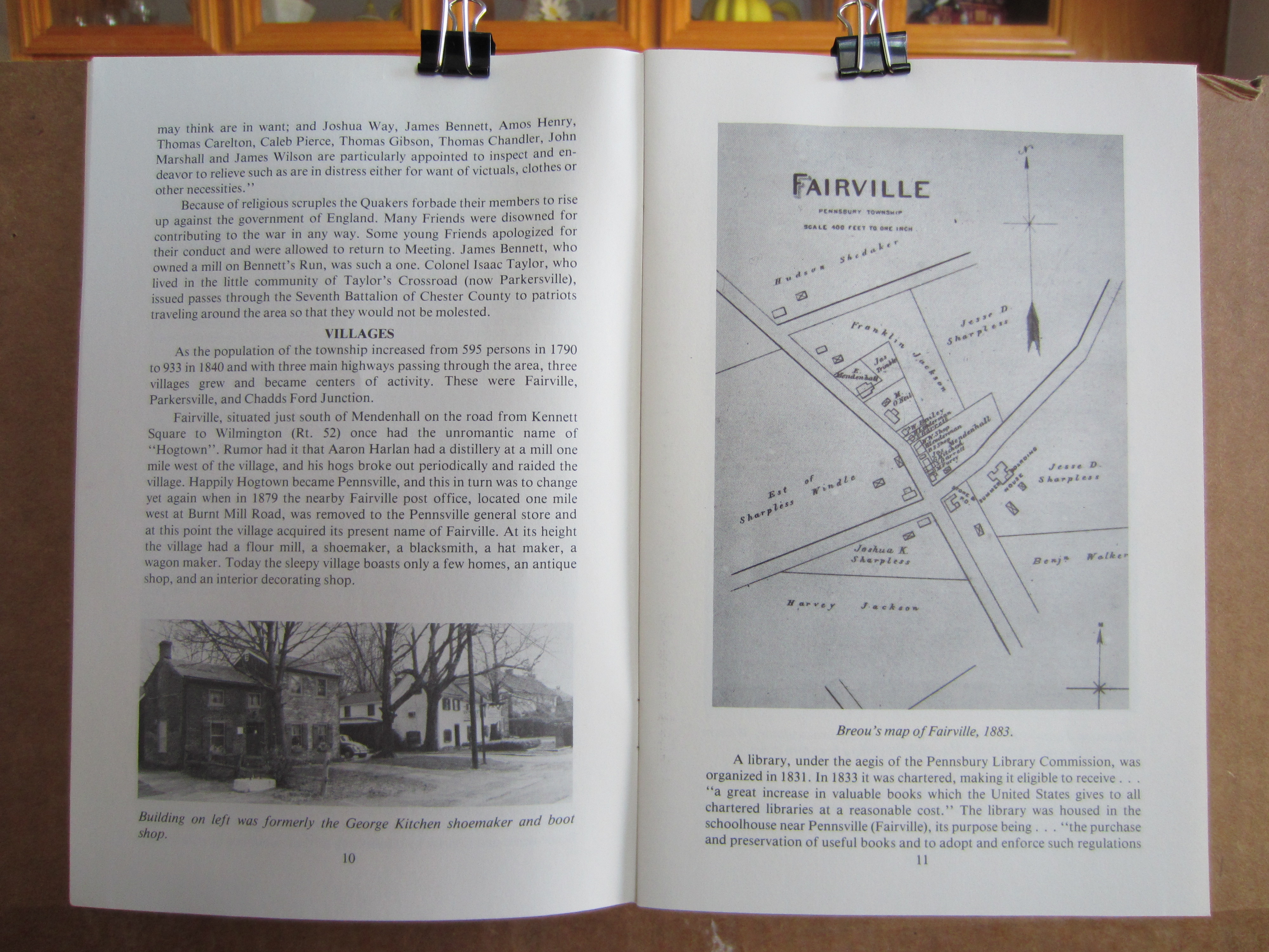
Page 10 (History; Fairville, Kitchen's shop photo) & Page 11, Breou's 1883 inset map of Fairville)
Page 12 (Fairville history, Wm Marshall Swayne birthplace photo), & Page 13 (Breou's 1883 insert map of Parkersville )
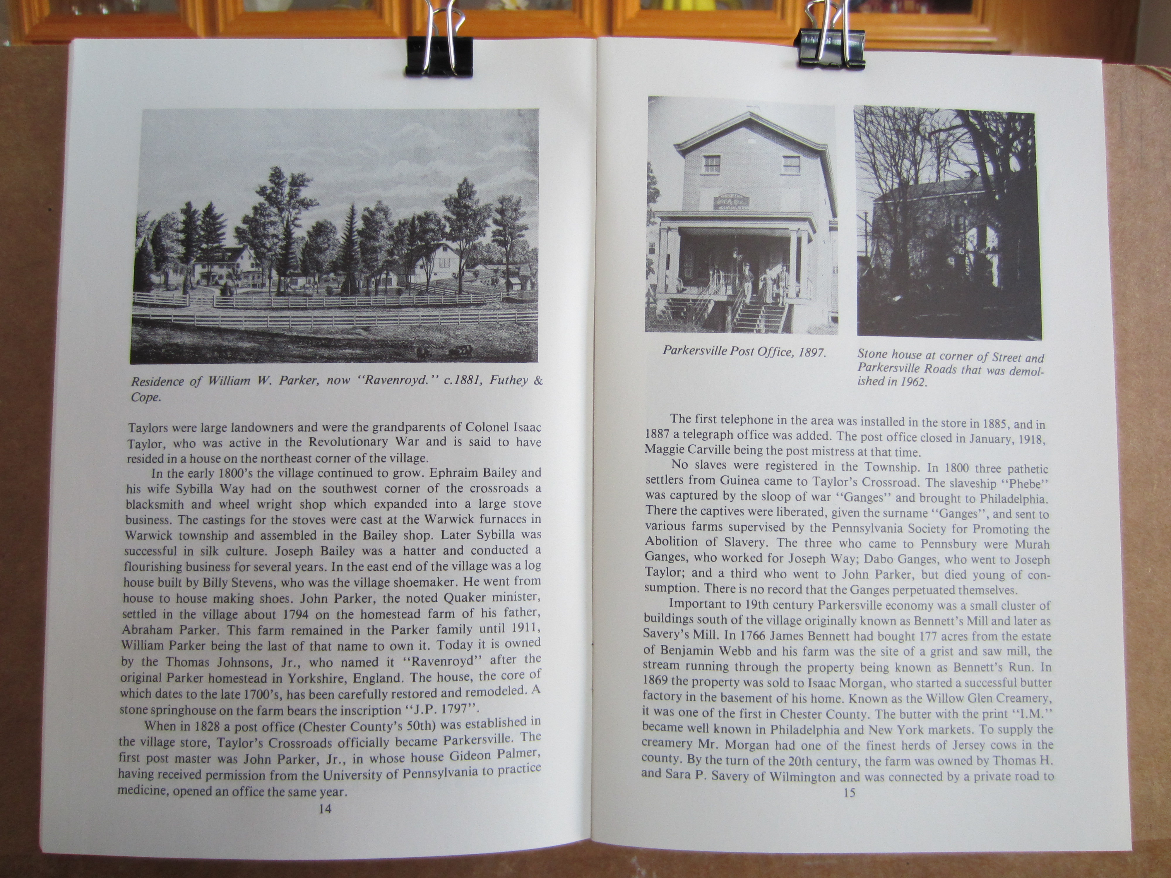
Page 14 (Residence of Wm W. Parker, "Ravenroyd"; Bailey/Parker/Taylor in Parkersville) & Pg 15 (Parkersville P.O. & house; Bennett's mill history)
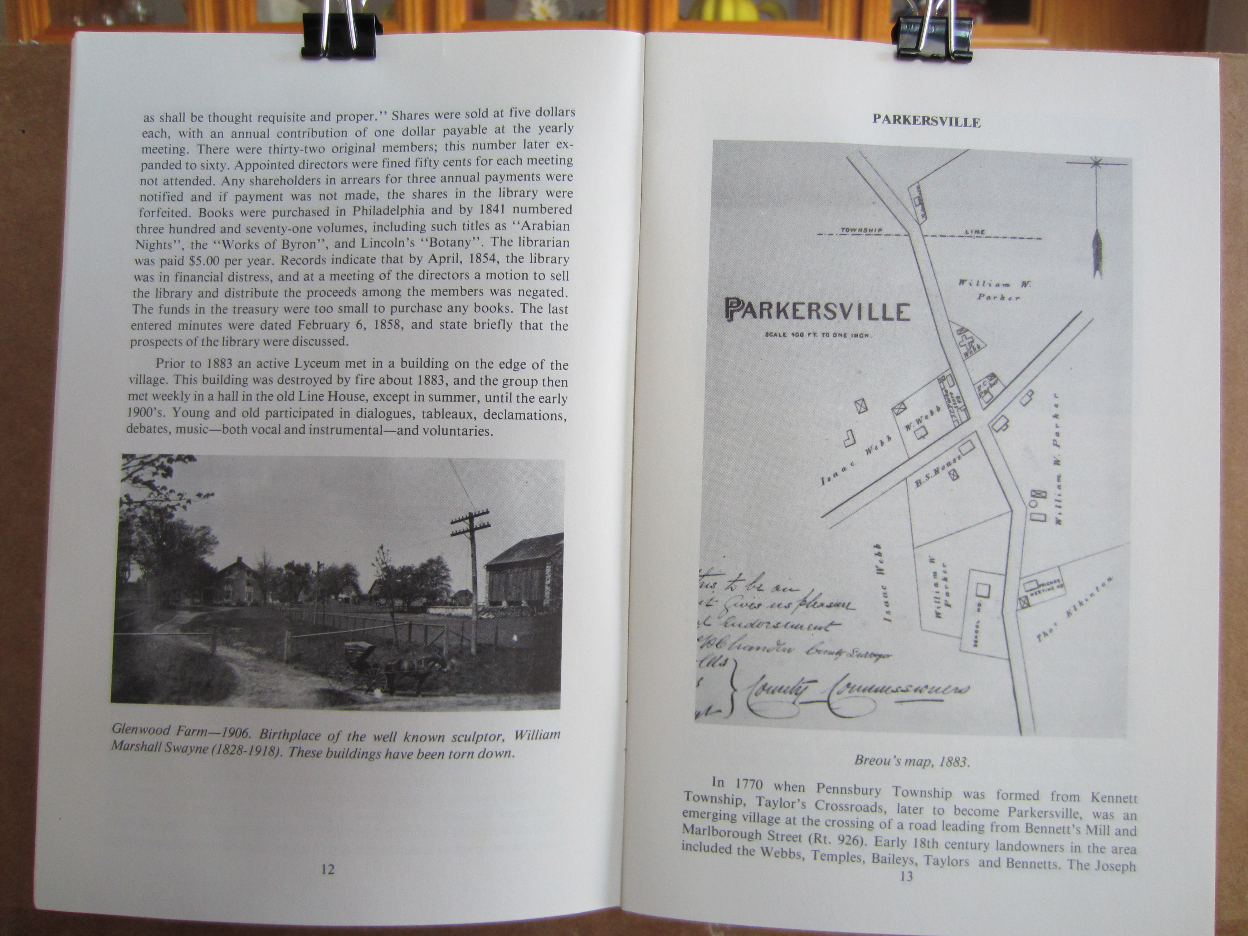
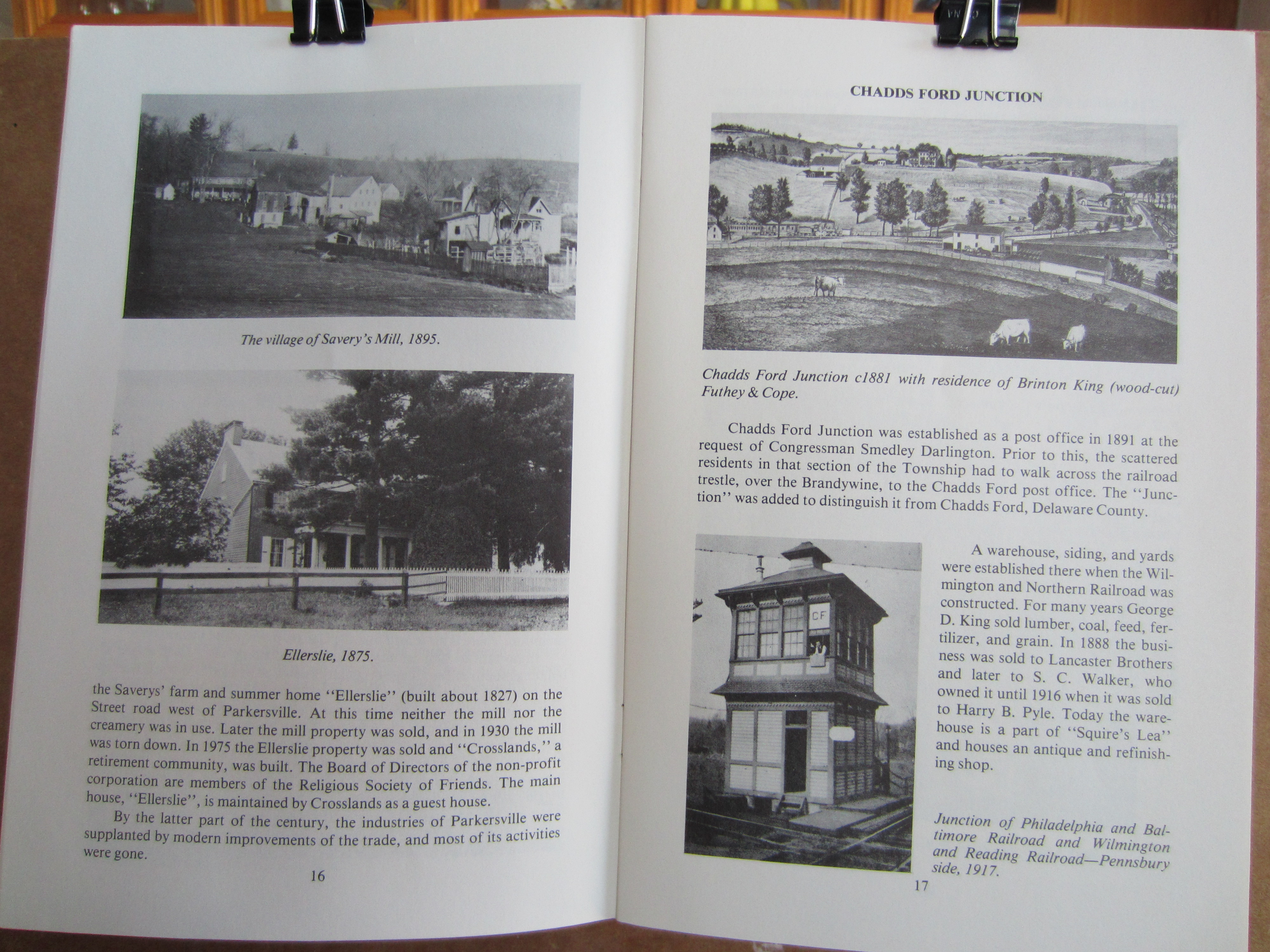
Page 16 (Photos of Savery's Mill village & Ellerslie ) & Pg 17 (Chadds Ford drawing; railroad junction)
Page 18 (Business photos along Street Road) & Pg 19 (Cossart Station photo etc.)
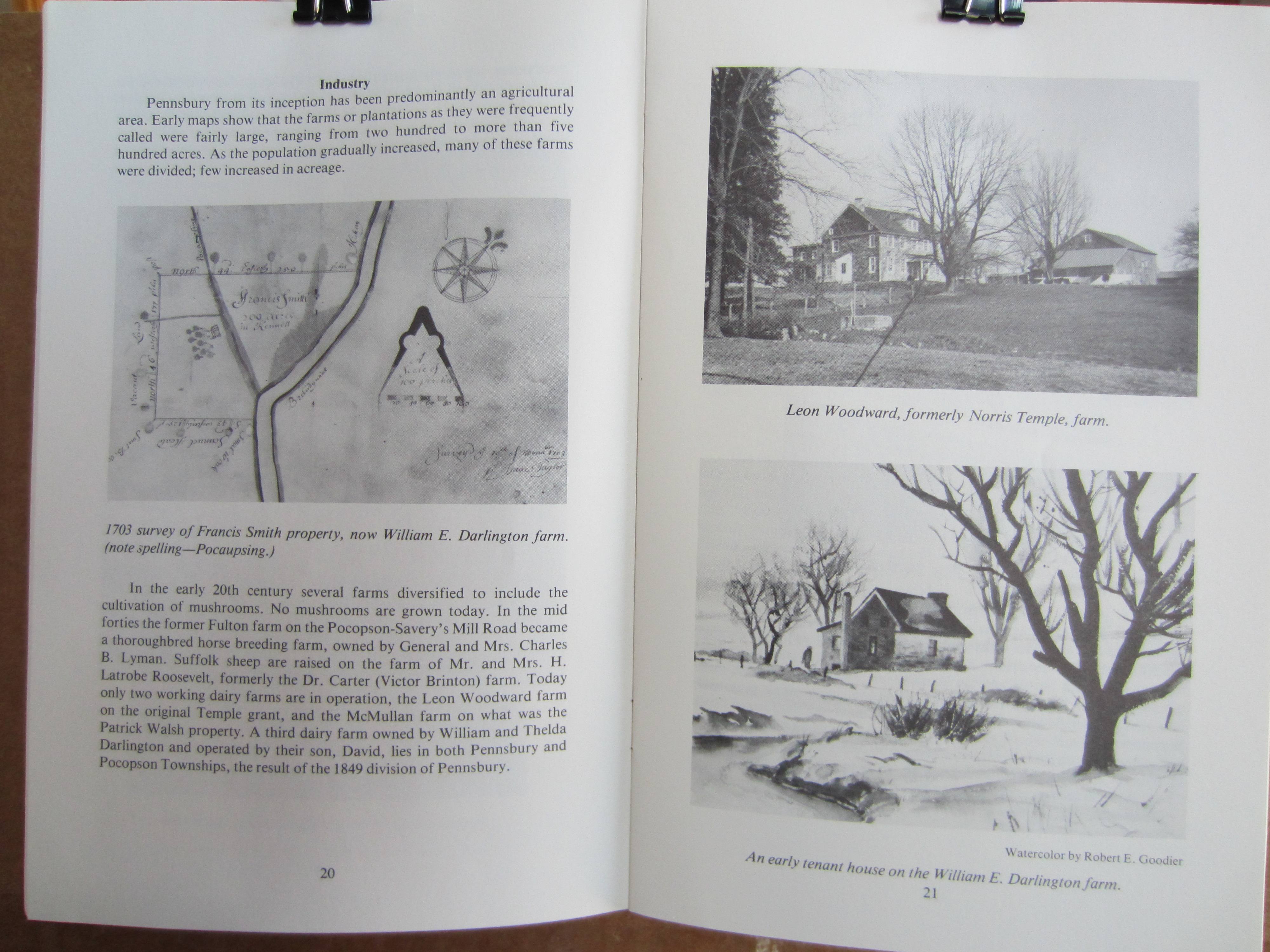
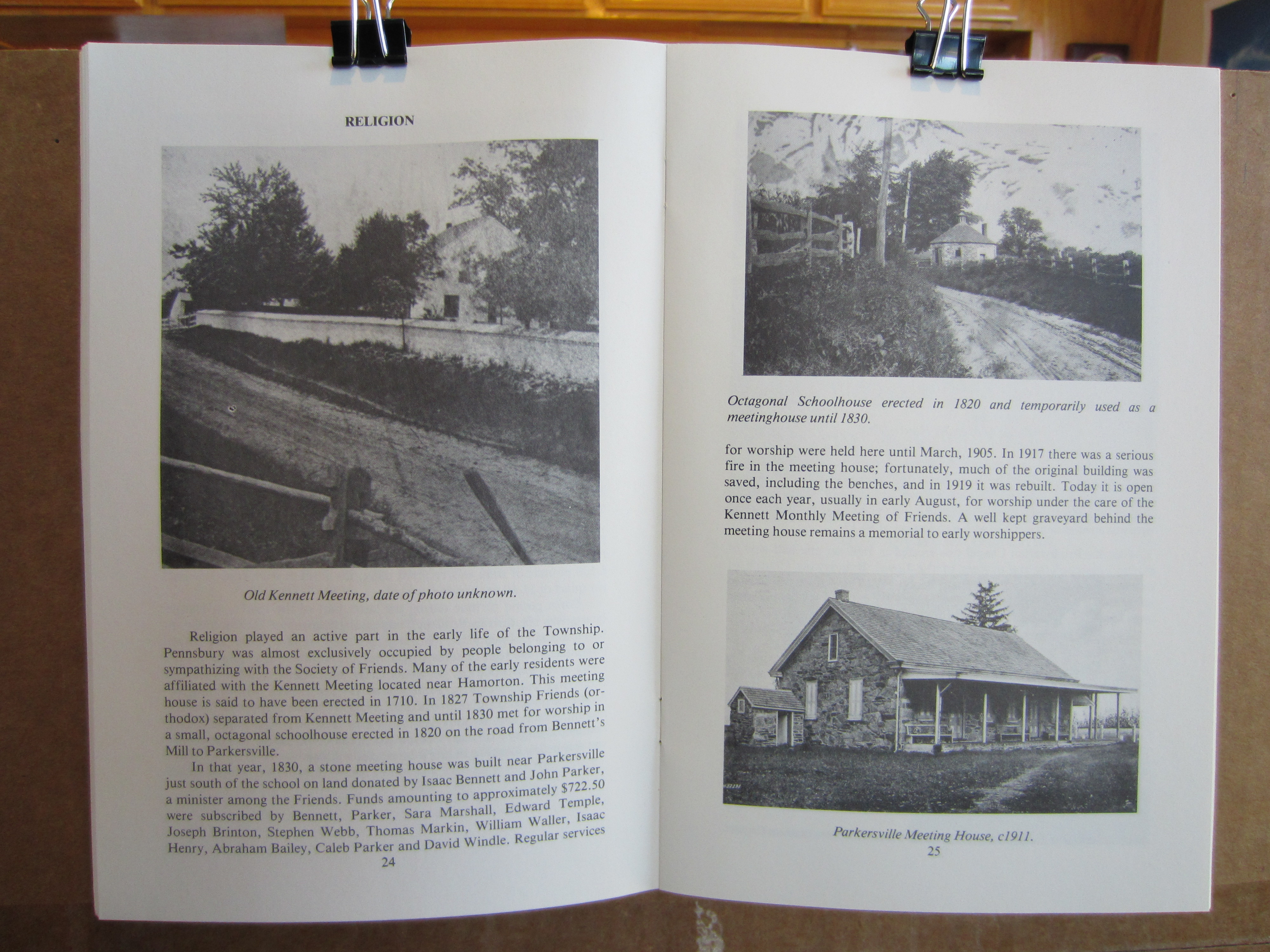
Page 20 (1703 survey of Francis Smith on Brandywine, Pocopsing) & Pg 21 (Photos of Temple/Woodward & Darlington houses)
Page 22 (Walsh/McMullan farm photo, creeks etc. history) & Pg 23 (Grist mill photo on Bennett's run; quarries etc history)
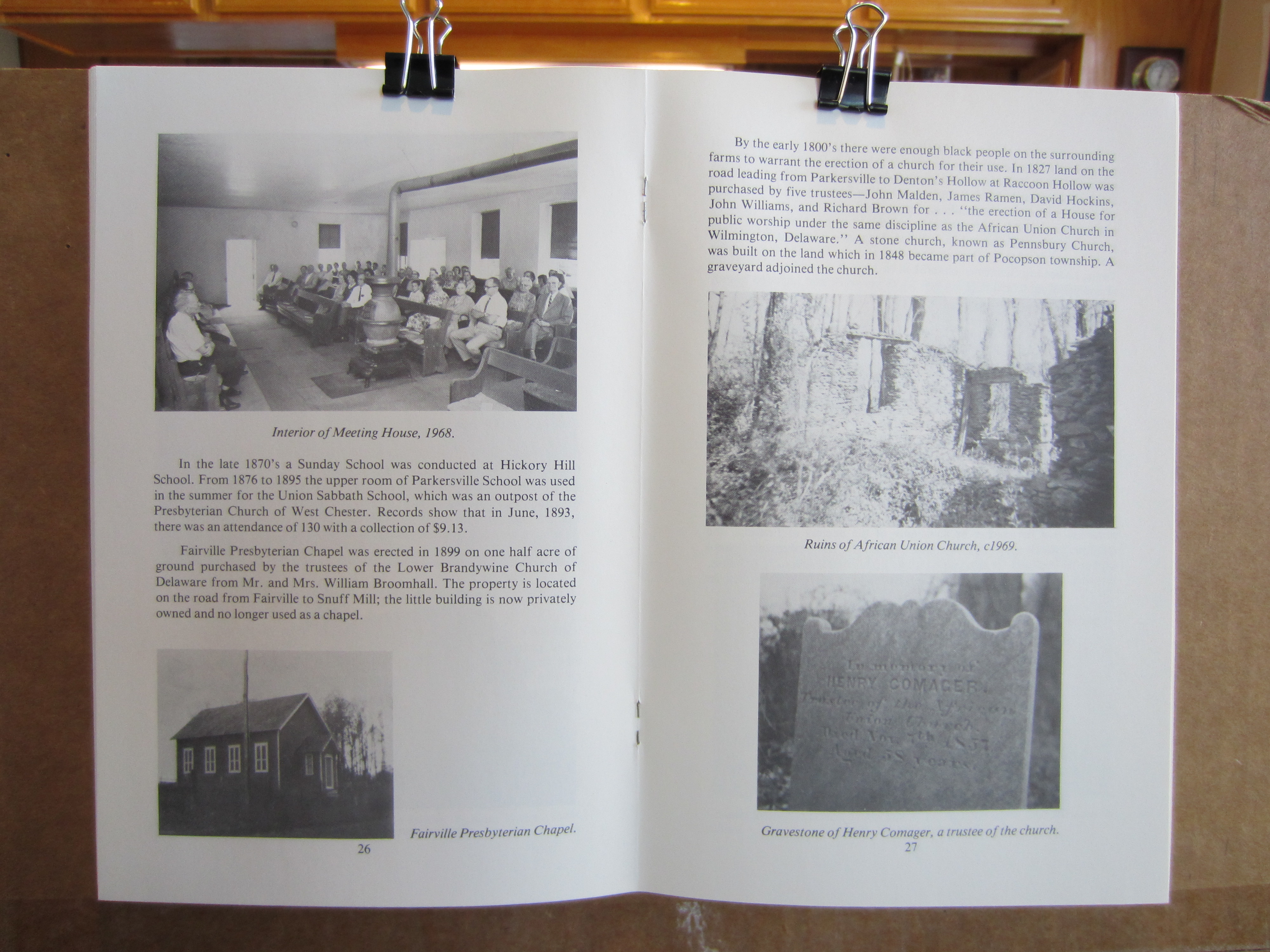
Page 24 (Old photo of old Kennett Mtg House with Rt. 1 as muddy lane) & Pg 25 (Photos of Octagonal Schoolhouse & Mtg House on Parkersville Rd )
Page 26 (Interior of Mtg House, Parkersville Rd , & the Fairville Presbyterian Chapel) & Pg 27 (Ruins of African Union Church; & gravestone)
Page 28 (Parkersville School photo etc.) & Pg 29 (Sketch of Cossart School)
Page 30 (Photo of Chadds Ford School, 1975) & Pg 31 (School history)
Page 32 (Photos, fording the Brandywine, & Chadds Ford Bridge) & Pg 33 (Bridge photos)
Page 34 (Bridge photos) & Pg 35 (Bridge & RR history)
Page 36 (Barns-Brinton House photo etc) & Pg 37 (Interior photo, Barns-Brinton etc)
Page 38 (Pennsbury Inn sketch, Springdale farm photo) & Pg 39 (Properties history, sketch of Aaron Mendenhall homestead)
Page 40 (William Peters house & a Harvey homestead) & Pg 41 (Pennsbury Inn photo, history etc)
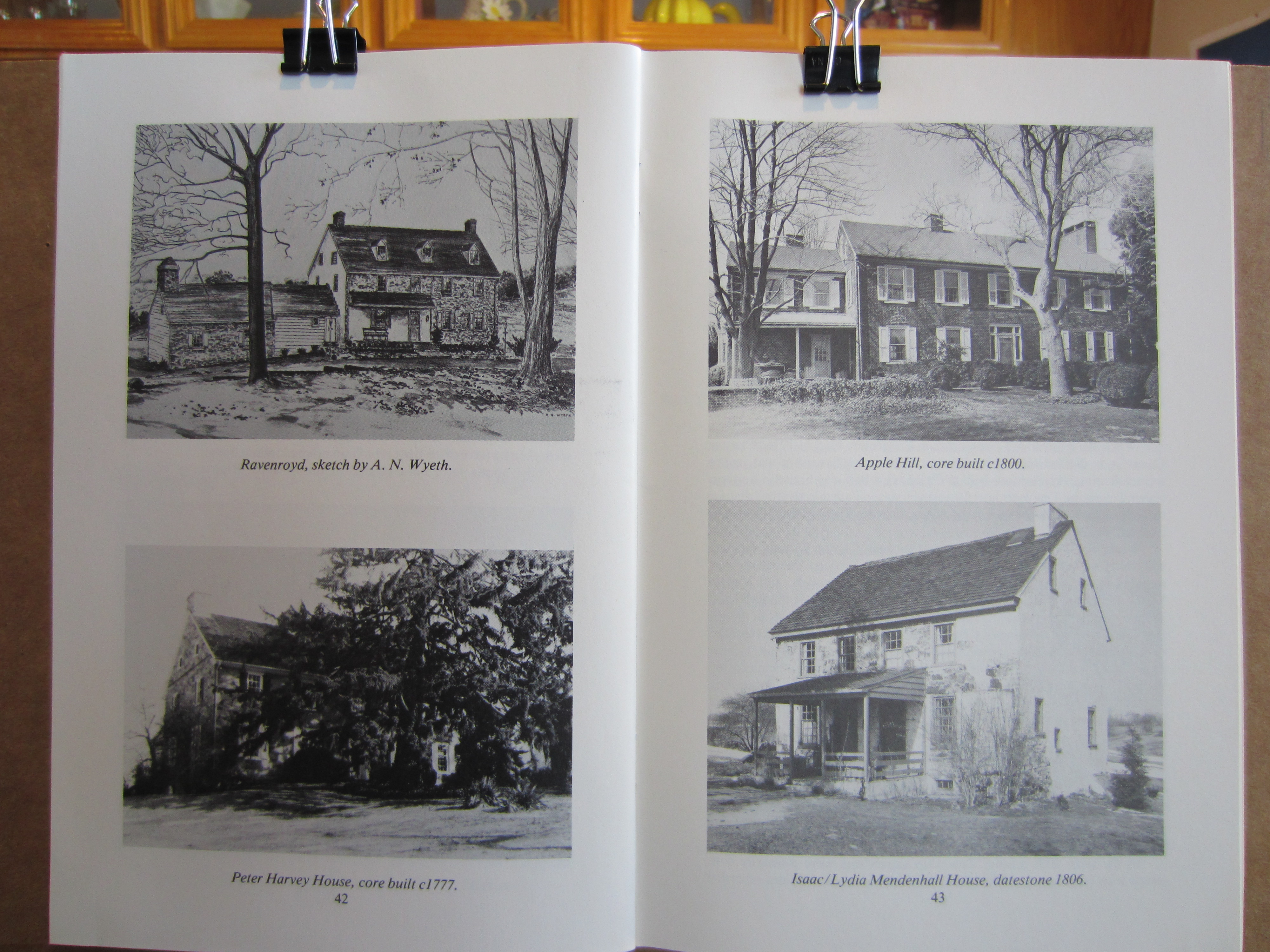
Page 42 (Ravenroyd sketch, Peter Harvey House ) & Pg 43 (Apple Hill house, Isaac/Lydia Mendenhall House)
Page 44-45 (Historic homes text, government, public buildings)
Page 46-47 (Township information)
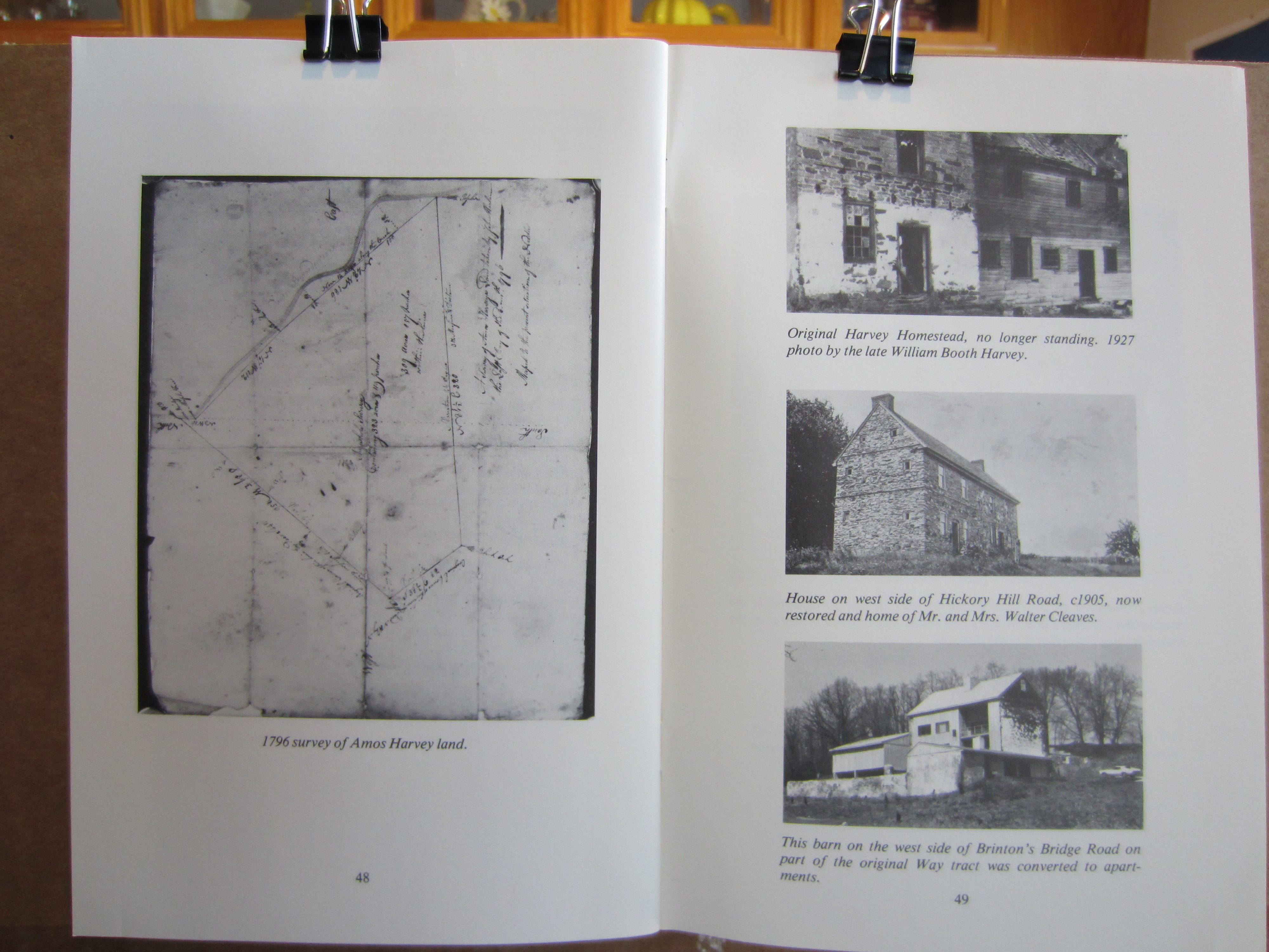
Page 48 (1796 survey of Amos Harvey land) & Pg 49 (Photographs of 3 old houses, Hickory Hill Rd, Brinton's Bridge Rd. etc)
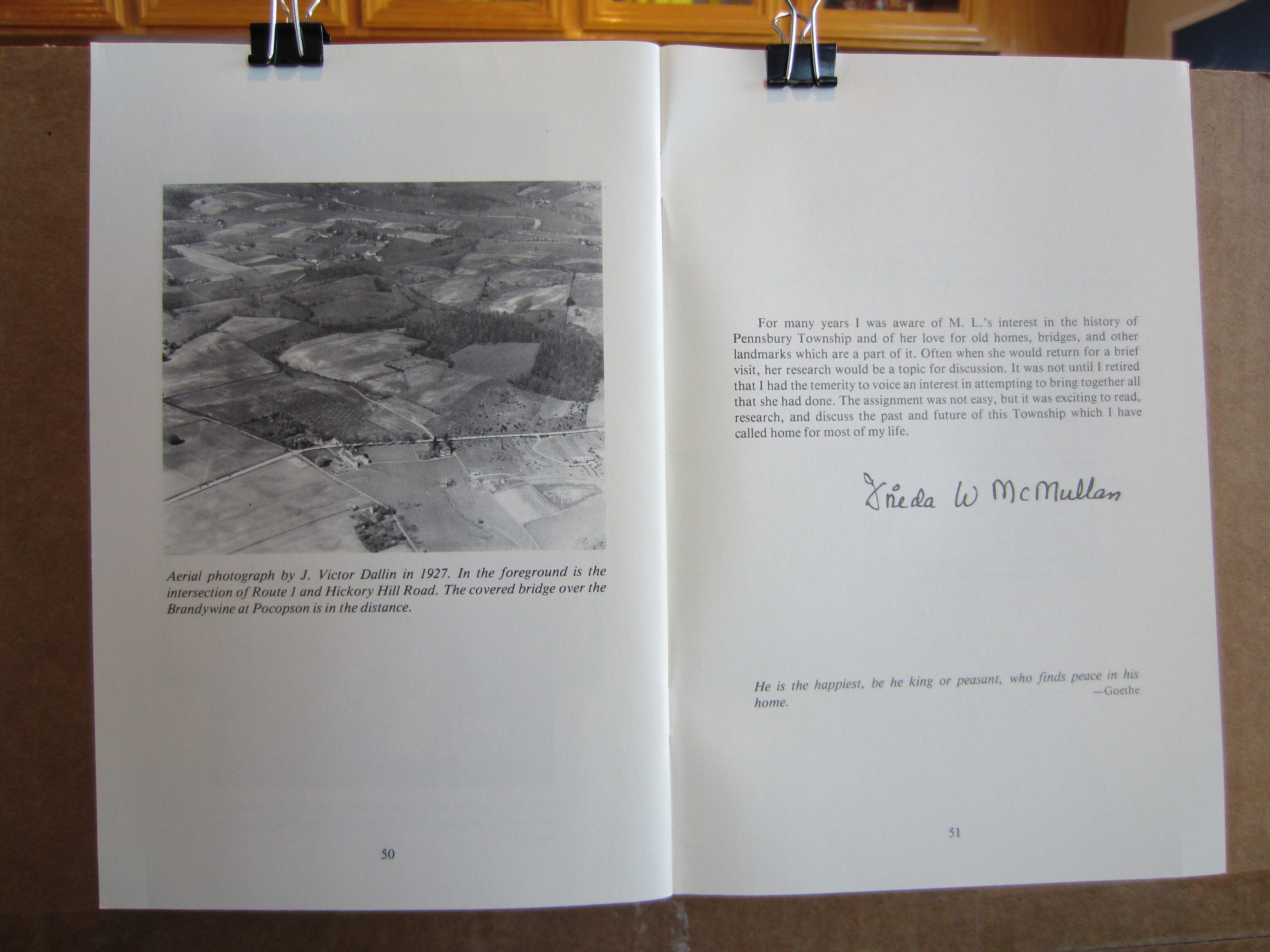
Page 50 (Aerial photograph , 1927, Route 1 at Hickory Hill Road ) & Pg 51 (statement by Frieda McMullen)
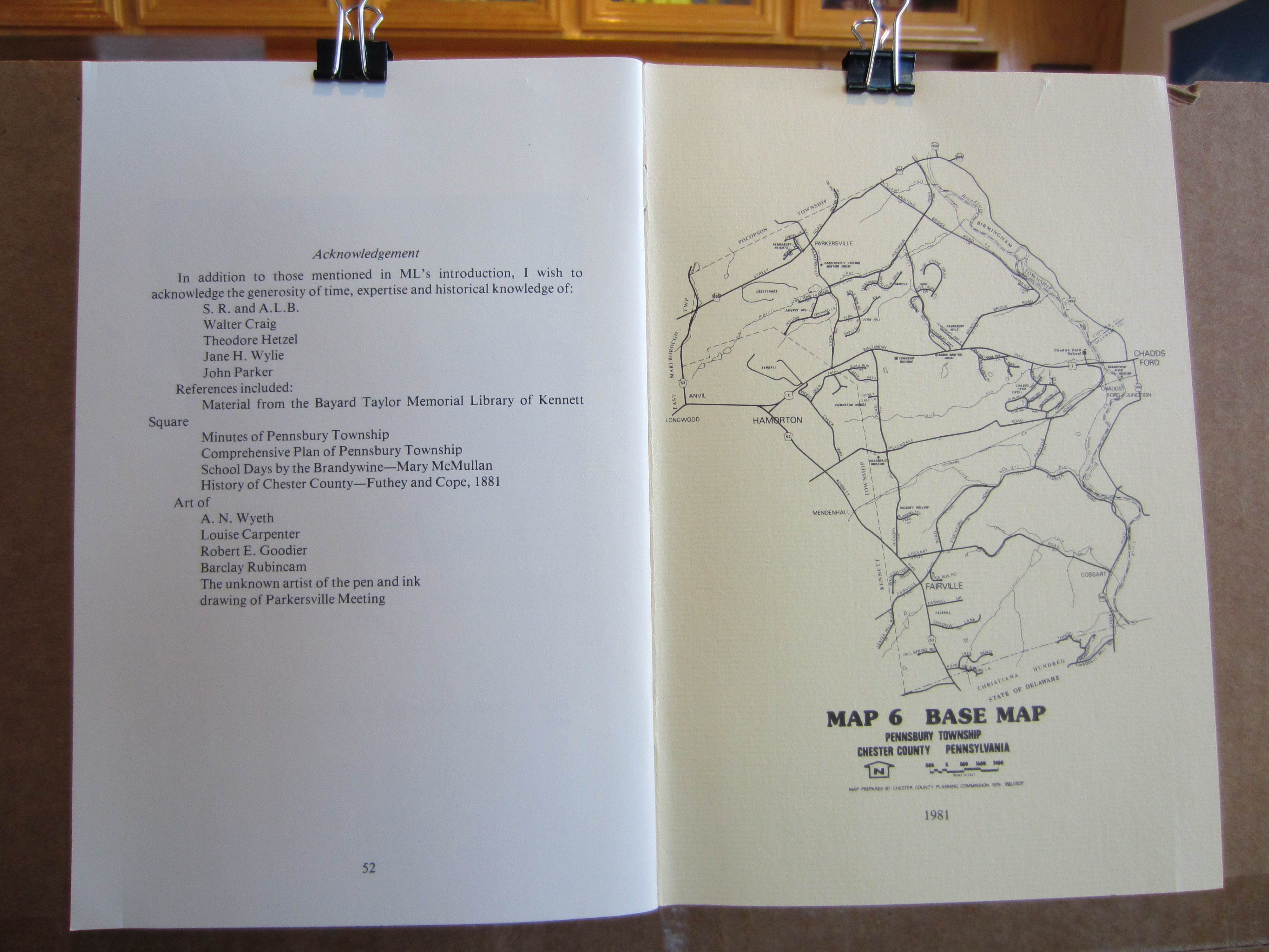
Page 52 (Acknowledgents) & Inside back cover (1981 map of Pennsbury )
This Web Page Created with PageBreeze Free HTML Editor